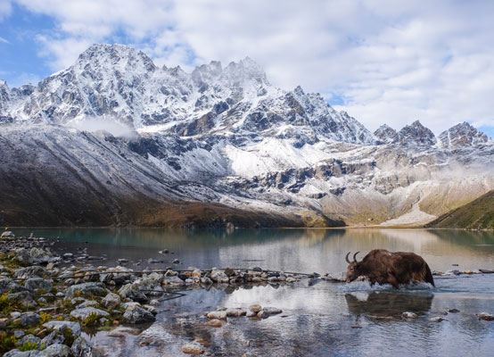
The Round Annapurna Trek is carried out in the Annapurna ranges of Nepal’s central Himalaya. Depending on where motorized transportation is used and where the walk is completed, the distance along the route ranges from 160 – 230 km. This journey encompasses the Annapurna Massif and travels through two separate river valleys. At Thorong La Pass (5416 m), the trail comes to its highest point and touches the edge of the Tibetan plateau. Almost all trekkers follow the route anticlockwise since it makes the high Thorong La pass crossing easier and safer and reduces daily altitude gain.
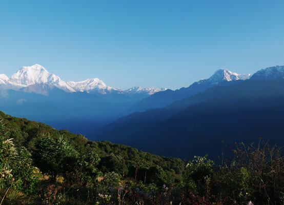
This trek has been regarded as the best long-distance trek in the world as it combined a wide variety of climate zones, from subtropical at 600 m altitude to arctic at 5416 m altitude at Thorong La Pass, as well as cultural diversity, from Hindu villages at the low foothills to the Tibetan culture of Manang Valley and lower Mustang. A road’s ongoing development has altered the towns and cut down on the route. A road between Besisahar and Manang has been constructed, and it frequently passes through a trekking route. Mountain bikers are becoming more attracted as a result of road development, and Mustang, in particular, has grown to become one of the most well-known mountain biking destinations in the world.
Trip Itinerary
Day 01: Arrive in Kathmandu
- On arrival at the Kathmandu International Airport, you will be met outside the customs and immigration area for transfer to your hotel.
- Overnight at a hotel in Kathmandu.
Day 02: Drive to Besisahar (177km) and trek to Khudi (approx. 02 hrs)
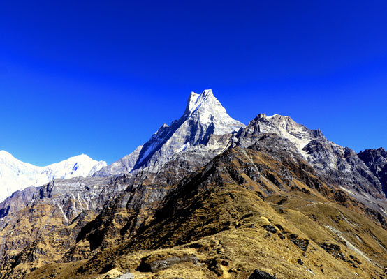
- The first part of the trail passes through a flat level along the bank of the Marshyangdi River. You can enjoy the scenery and the local culture of the Gurung Here we walk through the rice terrace fields with the good views of various mountains.
- Overnight at a simple
Day 03: Trek to Syange – 1190m (approx. 06 hrs)
- A steep trail ascends from Ngadi, through rice terraces, before crossing a stream at the bottom of a small waterfall. It then climbs again and traverses the hillside high above the river before reaching the village of Lili Gaon. Ahead, the Marsyangdi valley forms a steep V-shape, and we follow the winding mountain path down till Syange.
- Overnight at a simple
Day 04: Trek to Tal – 1675m (approx. 06 hrs)
- Along the river for some distance, the trail then climbs steeply and the path is cut into the sheer cliff-face some 200-300m above the riverbed. Eventually we descend to the stone village of Jagat, situated on a shelf, which juts into the precipitous Marsyangdi valley. The trail from Jagat descends until it almost reaches the river and then begins to climb again through a forest. The sheer cliff on the opposite bank plunges downward but this side is also steep.
- When the climb ends, we follow a level track to Chamje, which is marked by a magnificent waterfall on the opposite bank. After descending to the river and crossing a suspension bridge, we begin a climb to Sattare on a path so steep that it seems one slip would send us hurtling down into the valley.
- We continue on an undulating path above the river, and at one point, where a tributary flows in from the opposite bank, the main river becomes covered with huge boulders that hide the water. Climbing the zigzag path to the top of the hill, we see the level plain of Tal before us. Though it is enclosed by cliffs, the level area looks reassuring after the harrowing mountain paths just traveled
- We descend to a grassy riverbank, which leads to Tal with its hotels and teahouses. Here you can enjoy the exhilarating water fall.
- Overnight at a simple
Day 05: Trek to Bagarchap – 2160m (approx. 6.5 hrs)
- Beyond Tal, the valley narrows and the path becomes high and winding, and in several areas hewn from the rock itself. Beyond the small village of Karte, there is a bit more cliff-walking before the path drops again to the river. We cross a suspension bridge, and climb the short distance to the stone kani marking the entrance to Dharapani.
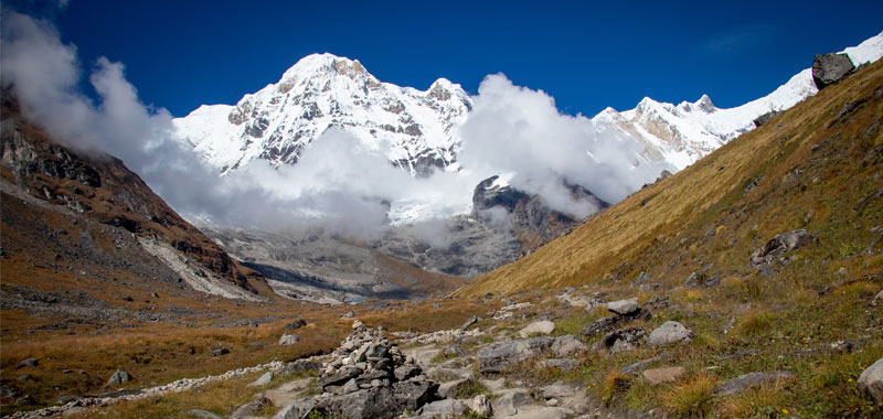
- As we cut through a narrow field from the village, the Dudh Khola, which originates from the south face of Manaslu, enters on the opposite bank. The Marsyangdi then veers to the left, and as Annapurna II becomes visible ahead, we arrive at Bagarchhap, a Tibetan village with prayer flags fluttering in the breeze.
- Overnight at a simple
Day 06: Trek to Chame – 2700m (approx. 6.5 hrs)
- Continuing along the left bank we will climb up the heavily wooded Manang Valley passing by the small settlements with excellent views of Manaslu and the peaks above Larky La. We pass through administrative headquarters of the region and the last major market before Jomsom. Chame also has a police check post and bank.
- Overnight at a simple
Day 07: Trek to Pisang – 3190m (approx. 05 hrs)
- With Lamjung Himal (6893m) sparkling in the morning sun, we set off for Pisang. The mountain disappears as we climb the path up the valley, passing a huge apple orchard. We continue through a fir and pine forest, climbing to a high, rocky area as the opposite bank becomes an impassable cliff. From this point, the valley becomes extremely steep-sided as we follow the path to Bratang.
- A short climb from the village brings us to a rock-strewn area where we cross a wooden bridge and follow a high, winding path, before crossing back to the right bank again. We now walk through a pine forest and as the forest ends, the valley changes from a V-shape to a gentle U-shape, opening up a wonderful vista before us. We can see the east peak of Annapurna II as well as Pisang Peak to the north-east.
- Continuing on, we come to a long Mani wall by a bridge and the lower village of Pisang.
- Overnight at a simple
Day 08: Trek to Manang – 3500m (approx. 05 hrs)
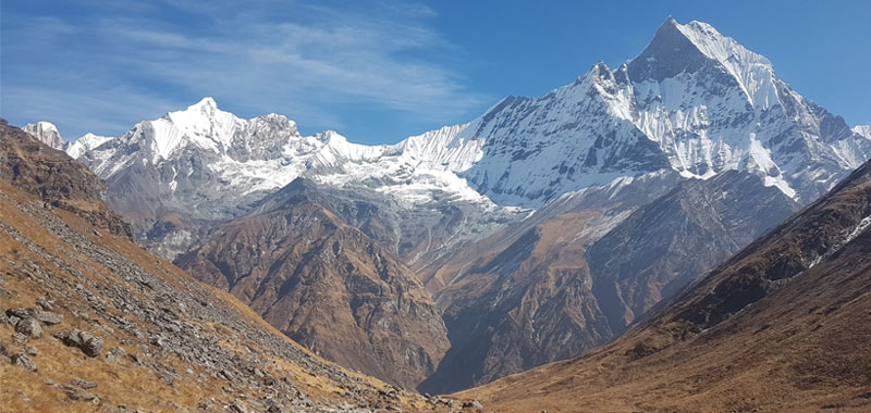
- Beyond Pisang, the trail climbs a steep ridge, which affords good views of the Manang valley and Tilicho peak. Descending past Manang’s airstrip at Hongdae, we come to a level area from where the north-east face of Annapurna III rises majestically above us. From the wide plains of the Sabje Khola Valley, Annapurna IV (7525m.) also becomes visible.
- Just beyond this point, we cross the considerably reduced flow of the Marsyangdi Khola via a wooden bridge to the tiny village of Mungji. Cultivated fields appear on both sides of the path and off to the right, below a craggy mountain, we can see the village of Bryaga with its splendid monastery. Large chortens and mani walls abound and the tall peaks of the Himalaya spread out before us – Annapurna II, Annapurna III, Annapurna IV, Gangapurna (7455m.) and, to the rear, Tilicho Peak (7134m.).
- After a short steep climb we reach Manang which is a surprisingly large village for this remote mountain region. We camp here for the night, amidst the fluttering prayer flags which adorn the houses.
- Overnight at a simple
Day 9: Manang – Acclimatize
- We are now in the dry arid region of Manang called Nyesyang. Since this area falls in the rain shadow area of the Himalaya it seldom rains in the summer months, though it snows in the winter and the snow remains on the ground for a long time.
- There are two routes leading out of Pisang towards the Manang valley. The one we will follow stays on the valley floor, on the left bank. Spectacular views of Annapurna III and IV along with Gangapuran and Tilicho peaks abound. This is possibly the best day for viewing mountains.
- We will pass through the village of Hongde where there is a STOL airfield servicing the Manang district. Crossing the river, just past the Manang Mountaineering School, we walk along a fairly broad trail to the fields near the village.
- Overnight at a simple
Day 10: Trek to Churi Leder – 4450m (approx. 04 hrs)
- Climbing up to Leder via Manang Tengi Gurung settlement the route passes through the juniper forests rose and barberry and a few meadows where yak and horse graze. We continue to walk to Leader through Yak Kharka also known as Koche where we can see the large herd of yaks graze in the fields nearby.
- Overnight at a simple
Day 11: Trek to Thorong Phedi – 4450m (approx. 03 Hours)
- Continue through pastures, which eventually give way to high arid desert to high camp at Phedi, at the base of Thorong La.
- Overnight at a simple
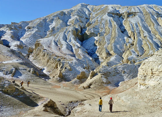
Day 12: Trek to Muktinath – 3800m via Thorong La pass – 5416m (approx. 8 – 9 hrs)
- Leaving the river valley, we set out early in the morning, provided the weather is good and it is not snowing. From Phedi ascend to a notch and turn left head for the Thorong La. The pass itself is marked by a cairn of rocks (this may not be visible if there is snow).
- Beyond the pass we enter the river valley of the Kali Gandaki River. The descent from the pass to Muktinath is steep but not difficult.
- Overnight at a simple
Day 13: Trek to Jomsom – 2700m (approx. 05 hrs)
- Trek down along a level but rocky trail through juniper thickets to Jomsom via Jharkot and Kagbeni, which are inhabited by the people of Tibetan origin.
- Overnight at a simple
Day 14: Fly to Pokhara. (820m) and connect flight to Kathmandu
- Early morning, fly from Jomsom to Pokhara.
- Then connect the flight to Kathmandu and drive to the hotel.
- Your day will be at leisure.
- Overnight at a hotel in Kathmandu.
Day 15: Day at leisure in Kathmandu
- Your day will be at leisure.
- Overnight at a hotel in Kathmandu.
Day 16: Final Departure
- After having breakfast, drive to the airport for your onward journey.
Important Notes
All information in this itinerary is accurate to the best of our knowledge but please note that changes to our trips can and do occur. This may be due to our effort to improve our program or logistical reasons such as changes in flight schedules, traffic conditions, weather conditions, or government policies. We will make every effort to keep you informed of any changes but cannot be held liable for any alterations made to the published itinerary.